

The Final Approach, Mapped
Battle Ground WA Airport Drop Off The Trip Is Won In The Last Three Miles.
Most of the miles from Battle Ground to PDX are just highway. The trip is decided in the final 3.07, our computed figure, from the moment two lanes peel off I-205 at Exit 24 onto an expressway the airport's own directions describe only as 'the Airport Way West exit.' This map covers what the signs assume you know: the exit's split personality, the landmarks in order down Airport Way, the upper-or-lower fork with garages P1 through P3 beyond it, and the roughly ten-minute penalty loop that punishes a missed curb. North county drives this approach for every departure; here is the version with the details filled in.
By Ilyas KhairiFounder, Marquee ChauffeurLicensed and permitted since 2018
- Licensed & Permitted
- $1M Insured
- 5.0 / 198 Reviews
- W-2 Chauffeurs
- 35-Point Inspection
Last updated: September 23, 2026
By Ilyas Khairi, Founder of Marquee Chauffeur · Licensed and permitted since 2018 · Updated September 23, 2026
TL;DR
Southbound from Battle Ground, two lanes exit I-205 at Exit 24 for Airport Way; northbound it splits into 24A (west, to PDX) and 24B (east). The final segment runs 3.07 computed miles in about seven free-flow minutes past the Economy lot, the cell phone lot at 82nd, and a 24-hour fuel stop for rental returns. At the terminal: departures up, arrivals down, garages P1 to P3 across the roadway. Miss your curb spot and the recirculation loop costs about three miles and ten minutes. Our drop-offs never meet it.
The highway leg from Battle Ground lives on the route guide, the curb's rulebook on the departures curb guide, and the day-of failures the approach can trigger on the day-of errors guide.
01 The Gate To The System
Exit 24, And Its
Split Personality.
The approach begins where I-205 sheds you. Southbound, the Battle Ground direction, two dedicated lanes depart at Exit 24 for Airport Way; northbound the same cloverstack interchange splits into 24A, the flyover ramp feeding Airport Way West and the terminal, and 24B toward Airport Way East. The comedy is that nobody official will tell you the number: the airport's own directions say only take the Airport Way West exit, and the search engines do worse: Google's answer box for the exit question has served up the airport in Portland, Maine. The practical rule survives all of it: from the north, stay right after the Columbia crossing, trust the PDX signage, and let the two-lane exit do the sorting.
The numbers, computed
The final approach from exit to curb is 3.07 miles in roughly seven minutes by our routing. The whole-trip arithmetic lives in the route guide; this map's jurisdiction begins at the off-ramp.
Two lanes, and why it matters
A double-lane exit means the departure-bank surge doesn't back onto the freeway easily, but it also means sorting happens on the ramp: airport traffic bears west, and the chauffeur who dawdles in the wrong lane meets the retail strip instead of the terminal. Decide before the ramp divides, not on it.
The 24A/24B tell
Northbound arrivals from Oregon see the lettered split, and the mnemonic is direction itself: West goes to wings. The flyover ramp of 24A is the primary PDX access, and everything signed East belongs to the cargo-and-commerce side of Airport Way's world.
The wrong-Portland hazard
Google answering an Oregon question with a Maine airport is funny until a visiting relative's navigation does something similar. The fix is the address, 7000 NE Airport Way, Portland, OR 97218, pasted into the guest's phone by their host, a one-text courtesy our hosting guides keep recommending for a reason.
02 The Corridor
Airport Way: An Expressway
With Landmarks In Order.
Past the ramp, Airport Way runs as a short expressway, first past a retail pocket, then into airport lands, and its roadside inventory is worth knowing in sequence. First comes the Economy lot, sited near I-205 off Airport Way by the airport's own parking page, with shuttles every seven to nine minutes through the day. Next, the cell phone waiting lot at NE 82nd Avenue, thirty vehicles, three minutes from the terminal, the designated answer to circling. Fuel hides on the cargo side, a 24-hour station on NE Air Cargo Road that the airport's own social channels have pointed rental-returners toward, a genuine mercy in a state where self-service rules still confuse visitors, and rental returns themselves follow lower-roadway signage at the terminal. Read once, the corridor stops being anonymous: every errand of an airport run has an address on this road, in this order.
The rental-return sequence
Visitors returning cars run the corridor's full inventory: fuel on Air Cargo Road, then lower-roadway signs to the Rental Car Center. The forums' hard-to-find-gas laments are pre-knowledge problems; with the order memorized, the return adds ten minutes, not a frantic thirty.
The cell lot's real geometry
At 82nd and Airport Way, the waiting lot sits a three-minute sprint from the curb, which is the whole point: a family member driving themselves can wait there and turn an arriving traveler's ready text into a near-immediate curb meeting. Its rules and limits belong to our red-eye guide; its position belongs to this map.
Construction weather
The corridor still carries renovation footnotes, the airport's pages currently flag partial baggage-claim closures with detour signage, and the printable map has noted a tunnel closed at times. Approach maps age; the posted sign outranks the remembered layout every single week.
Counterflow, inherited
North county's structural gift applies to the corridor too: the predawn drop-off surge runs against the commute our cross-river map documents, and Airport Way's own congestion peaks with the departure banks, not the rush hours. Timing the approach is mostly timing the terminal, which dispatch already does.

03 The Fork
Upper Or Lower, Curb Or Garage:
The Half-Mile Of Decisions.
The terminal announces itself with the approach's only real decisions, stacked into a half mile. First the vertical fork: departures ride the ramp to the upper roadway, arrivals stay low, the split the airport's guidance describes as drop-off and pick-up areas on either the upper or lower level roadways. Commercial traffic sorts once more, outer lanes for permitted vehicles, the geometry our departures-curb guide details. And facing it all stand the garages the printable map names plainly: Short-Term P1, Long-Term P2 and P3, with the Rental Car Center alongside and tunnels connecting to the terminal, the walk-in option for every send-off that deserves more than a curb's minutes. The craft is deciding before the concrete does: upper for going, lower for coming, P1 for the goodbye that walks inside, chosen back on Airport Way rather than at the painted gore point.
Our chauffeurs make the fork call at the ramp, briefed by the booking: (503) 706-8662.
P1, the send-off garage
The walk-in goodbye our send-off errors guide prescribes runs through P1: across from the terminal, hourly rates, tunnels and skybridges inside. For the elderly parent or the semester-abroad departure, the correct answer to the fork was never the curb at all, and P1's name is on the map for exactly that reason.
The late-merge tax
Most approach mistakes are one missed decision surfacing late: the arrivals-level realization made on the departures ramp, the garage entrance spotted at the last car length. Each costs a partial or full loop. The fix is unpoetic: know your level before 82nd Avenue, and the fork becomes a formality.
Airline-side curb aim
On the upper roadway, the remaining choice is longitudinal: stopping nearest your traveler's airline aisle saves the luggage walk, craft our departures-curb guide covers. The map's contribution is just the reminder that the curb is long, and the first open spot is rarely the right one.
Arrivals, the mirrored fork
Pickups run the same half mile aimed low, meeting the numbered pick-up locations and garage-side plaza our arrival guides map. One approach road, two missions, mirrored forks: learn it once as a drop-off driver and the pickup version comes free.

04 The Penalty Loop
Miss The Curb, Pay
Three Miles And Ten Minutes.
Every approach map needs its cautionary figure, and ours is computed: overshoot your curb spot or exit the roadway un-unloaded, and the recirculation loop back through the Airport Way system runs about 2.9 miles and ten free-flow minutes before you face the terminal again, longer whenever the departure banks crowd the roadway. The airport's published anti-circling advice is the cell phone lot, correct for pickups, but a drop-off has no business needing it: the loop is pure prevention territory. Prevention is this guide in one sentence, the exit known by number, the corridor's landmarks in order, the fork decided early, the curb aimed by airline, and it is also, candidly, the product: a professional approach briefed the night before never meets the loop, which is a small perfection multiplied across every departure a household ever makes. The Drop Off series closes here, eight angles deep, on the three miles where all of them land. The mirrored approach on the return leg can end inside baggage claim with a meet-and-greet pickup at PDX.
When the loop is worth taking
One honest exception: a forgotten-item recovery, the passport realized at the last light, is a loop gladly driven, and ten minutes is a bargain against the alternatives our send-off errors guide prices. The loop is a penalty only when it was avoidable; as a second chance, it is the cheapest one at the airport.
The buffer the loop justifies
Ten possible penalty minutes are one more line in the doorbell arithmetic: the north county departure that budgets them never needs them, and the one that doesn't is gambling its bag cutoff on a clean first pass. Our punctuality guide runs the full equation; the loop is simply its local constant.
The whole run, one booking
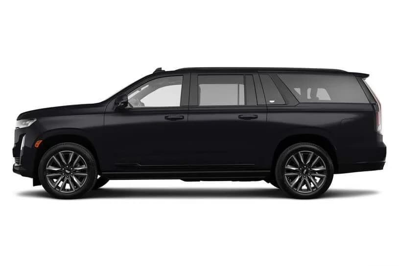
A booked Battle Ground drop-off buys the entire chain rehearsed, the highway miles, Exit 24's sorting, the corridor, the fork, the airline-aimed curb, at about $185 in the Volvo S90, $270 in the Escalade ESV, $430 in the Sprinter, flat, with the return pickup's mirrored approach bookable in the same call.
The standing approach file
North county households keep the map on file through Battle Ground limo service: preferred airlines and their curb stretches, the P1 walk-in preference for certain travelers, the whole final approach pre-decided. Highway miles, three miles of craft, zero loops.
Frequently Asked
Questions, Answered.
What exit is the Portland airport?
Airport Way off I-205: southbound from Battle Ground, two lanes depart at Exit 24; northbound the interchange splits into 24A for Airport Way West, the flyover that serves PDX, and 24B for Airport Way East. The airport's own directions never print the number; they just say take the Airport Way West exit, and the search engines are worse: Google's answer box has been known to cite the airport in Portland, Maine. Trust the signs that say PDX, and trust 24.
Is Portland Airport (PDX) easy to navigate?
By big-airport standards, genuinely yes: one terminal, one approach road, garages named P1 through P3 directly across from the doors, and a curb system that splits cleanly into departures above and arrivals below. The traps are small and specific, the upper-versus-lower choice made late, the curb spot overshot, and each costs a loop measured in miles rather than steps, which is exactly what this map exists to prevent.
What does cell phone waiting area mean at an airport?
A free short-stay lot where drivers wait with their vehicles for an arriving traveler's ready call, instead of circling the terminal roadway. PDX's sits off NE Airport Way at 82nd Avenue, holds about thirty cars, and reaches the terminal in roughly three minutes, which is why the airport's own advice for anyone waiting is to use it rather than orbit. It serves pickups; drop-offs should simply unload and go.
Where does Uber drop off at PDX?
Rideshare drop-offs use the upper departures roadway, with drivers directed to the outer commercial lanes, per the guidance the platforms give their own drivers. That mirrors the airport's broader geometry: commercial operators run the outer roadway while private cars use the inner curb. Pickups are the different story: rideshare and taxi riders are directed into Level 1 of the short-term parking garage, while a booked chauffeur meets you at island 3 outside baggage claim on the lower roadway.
Does this Battle Ground drop-off route work in reverse for PDX pickups?
Yes. The pickup is this map mirrored: the same Exit 24 approach and Airport Way corridor, aimed low instead of high, because arrivals load on the lower roadway outside baggage claim at the numbered pick-up locations. On a booked pickup the chauffeur holds at the airport entrance, moves on the wheels-down call rather than circling the roadway, and meets you at island 3 outside baggage claim, or inside baggage claim if you add the meet-and-greet.
How early does a Battle Ground drop-off need to be on the books?
Twenty-four to 48 hours covers a standard date and leaves room for the night-before briefing this map describes, the fork decided, the curb aimed by airline. Holiday and shoulder-Sunday departures deserve more runway, since those mornings book out first. Same-day requests go through dispatch at (503) 706-8662 and run subject to availability, so the earlier call is always the calmer one.
About the Author
Ilyas Khairi runs Marquee Chauffeur under Portland Bureau of Transportation certification held since 2018, with $1 million in commercial liability and W-2 chauffeurs on payroll. He has driven the Exit 24 approach more times than any road in his life, decides the fork before the ramp on principle, and has taken the penalty loop exactly as often as a passport has been remembered at the last light.
Verified Google Reviews
What Portland clients say about Marquee Chauffeur.
I spent six hours touring the Columbia River Gorge with the owner of this service, and I was really impressed with his professionalism, attentiveness, and local knowledge. As he says, they really are like a chauffeur/concierge, not just taking you from one place to another but providing a full experience. I look forward to riding with them again on my next trip.
Edris — has absolutely hands down have to be the best driver ever. I would absolutely recommend his service! He's so professional, so efficient. On time and so respectful!
These guys are terrific. Two thumbs up. Found them online and got excellent personal service. Used them to get from PDX to about two hours away …. And then back to PDX a few days later. On time. Super professional drivers. Vehicles in spectacular shape. Brand new. They will be out go to service. We recommend them highly.
Marquee Chauffeur holds a 5.0 rating across 198 Google reviews. Read every review on Google.
Reserve Your Chauffeur
Reserve a Portland
Chauffeur Now.
Buy the last three miles pre-rehearsed: (503) 706-8662, available 24/7. Battle Ground drop-offs at about $185 in the Volvo S90, $270 in the Escalade ESV, $430 in the Sprinter, flat-quoted with the approach briefed the night before, the curb aimed by airline, zero penalty loops, and the return pickup bookable in the same call, under Portland private-for-hire permitting since 2018 with $1 million in commercial liability.