

East Clark County, Street By Street
Camas WA Airport Car Service Every Neighborhood, Door To Terminal.
Camas is one town on a map and half a dozen different pickups in practice. A Grass Valley departure is the shortest airport run on our board. A Prune Hill pickup in January consults the city's snow-closure list before it consults the clock. Lacamas Shores rides an extra bridge quirk this fall, and Washougal skips the whole hill question entirely. This is the airport run as our dispatch notes actually describe it, neighborhood by neighborhood.
By Ilyas KhairiFounder, Marquee ChauffeurLicensed and permitted since 2018
- Licensed & Permitted
- $1M Insured
- 5.0 / 198 Reviews
- W-2 Chauffeurs
- 35-Point Inspection
Last updated: September 23, 2026
By Ilyas Khairi, Founder of Marquee Chauffeur · Licensed and permitted since 2018 · Updated September 23, 2026
TL;DR
Camas airport pickups span about four miles and six minutes by neighborhood: Grass Valley closest at roughly 11.7 miles to PDX, the Camas High School side furthest at about 15.3, with Prune Hill in between and subject to the city's formal winter street closures on its grades. Every neighborhood books the same way: a locked rate, a scheduled window, and seasonal routing already in the plan.
The route, bridge, and transit picture lives on the Camas to PDX airport guide. Ongoing sedan work sits on Camas town car service, and event work on Camas limo service.
01 The Map
How Far Is Each Neighborhood
From The Terminal?
Measured over OpenStreetMap road routing at free flow, the spread surprises people: Grass Valley reaches PDX in about 11.7 miles and 23 minutes, downtown Camas 13.2 and 23, Prune Hill 12.5 and 24, Lacamas Shores 14.1 and 26, the Camas High School side about 15.3 and 29, and downtown Washougal 15.6 and 25. Four miles, six minutes, one shared funnel onto SR-14 West and I-205 North. The differences that matter are not the miles; they are the grades, gates, and seasons attached to them.
| Neighborhood | Miles to PDX | Free-flow time | Dispatch note |
|---|---|---|---|
| Grass Valley | ≈ 11.7 | ≈ 23 min | Shortest run on the board |
| Prune Hill / Dorothy Fox | ≈ 12.5 | ≈ 24 min | Winter closure list applies on the grades |
| Downtown Camas | ≈ 13.2 | ≈ 23 min | Flat, fast, event-night staging aside |
| Lacamas Shores / lake side | ≈ 14.1 | ≈ 26 min | Park bridge construction from August 2026 |
| North Camas / Camas HS side | ≈ 15.3 | ≈ 29 min | Longest run; earliest pickup window |
| Downtown Washougal | ≈ 15.6 | ≈ 25 min | Columbia flats; steadiest winter run |
Distances and times computed 2026 via OpenStreetMap geocoding and OSRM routing at free flow, no traffic. Peak windows add time on I-205; dispatch schedules against the slow figure, not this one.

02 The Hill
What Should A Chauffeur Know
About Prune Hill?
That it is a volcano, for a start: Prune Hill is an extinct vent of the Boring Lava Field, named for the orchards that made Clark County the self-styled prune capital of the world until the Depression collapsed the market. What matters at 4:45 a.m. in January is the modern consequence of that geology: grade streets the City of Camas formally closes in inclement weather, including stretches of NW 23rd Avenue, NW Forest Home Road, and NW Dahlia Drive, with residents on steep streets told plainly to prepare for delays.
The closure list is the plan
The city runs four plows and two deicing units across 65 miles of priority routes, and its policy names the hill streets that simply close when ice arrives. Dispatch keeps that list in the Camas notes; a storm-morning pickup on an affected street gets an adjusted meeting point at the bottom of the grade, agreed the night before, not negotiated at dawn.
The Dorothy Fox marker
Dorothy Fox Elementary on NW Sierra Street is the neighborhood's working landmark, and NW Sierra itself appears on the city's priority plow map, which makes the school a reliable winter rendezvous when a cul-de-sac two streets up is glazed. Residents joke about needing AWD to live on the hill; the dispatch version is that the meeting point moves downhill before the forecast does.
Fast access, by design
Locals recommend Prune Hill precisely for its quick drop to SR-14, and they are right: 12.5 miles to the terminal is closer than downtown. The residential descent is the trade, worth a minute on a dry morning and worth planning on a frozen one. Three seasons a year, the hill is the easy pickup.
A foot of snow, occasionally
When lowland Clark County gets an inch, hill residents post about a foot, and the elevation difference is the whole explanation: the summit area sits hundreds of feet above Washougal's river flats. The Escalade takes the hill assignments in marginal weather, and the pickup window gets built with the grade in it.
03 The Lake Side
Grass Valley, Lacamas Shores,
And The Trail Country?
Grass Valley is the quiet winner of the airport map, closest to the terminal at about 11.7 miles, anchored by Grass Valley Park on NW 38th Avenue with its ballfields and pickleball courts serving as the pickup landmark half our notes reference. The lake side is lovelier and longer: Lacamas Regional Park's 312 acres and the 3.5-mile Heritage Trail define the geography, and from August 2026 the county is replacing the aging bridge on the park's main access road in the northeast corner, a detail worth knowing if your street feeds that corner.
Whichever side of the lake you wake up on, dispatch will set your pickup window in one call: (503) 706-8662.
Grass Valley's short run
Twenty-three free-flow minutes is a number that changes behavior: Grass Valley clients book later pickups than anyone else in Camas and still carry margin. The park entrance makes a clean meeting point for households mid-move or hosting guests who would rather not direct a stranger to a new address.
Lacamas Shores logistics
The lake neighborhoods ride NW Lake Road to SR-500 or drop south to SR-14, and the county's own trail sheet notes there is no bus service within a mile of the Heritage Trail corridor, which is the transit picture for the whole shore in one sentence. Door-to-door is not a luxury here; it is the only scheduled option.
The August bridge note
Clark County begins replacing the Lacamas park access bridge in August 2026, closing trails and the northeast entrance area during work. Airport runs are unaffected on the highway side, but pickup routing from the park-adjacent streets shifts while the detour holds, and the dispatch notes already say so.
North Camas mornings
The high school side is the far edge of the map at about 29 free-flow minutes, so its 6 a.m. departures book the earliest windows in town. The reward for the extra miles is the easiest loading in Camas: wide streets, flat driveways, and no grade in sight.

04 The Flats
Downtown Camas And
Washougal, The Steady Runs?
Downtown Camas, a mill town founded in 1883 and revitalized into the gallery-and-restaurant grid visitors now drive out for, is the easiest pickup in the city: flat, gridded, and 23 minutes from the terminal. Washougal next door is its own city and its own story, about 17,900 residents on the Columbia flats at the gateway to the Gorge, projected by its own planners to pass 22,000 by 2035. Growth is the quiet theme on both sides: Camas has added roughly 1,200 residents since the 2020 census, and every one of them eventually needs a ride to a plane.
The elevation dividend
Washougal's downtown sits at about 82 feet of elevation against Camas's 712, and in a Gorge-wind cold snap that difference is the forecast. When the hill neighborhoods are consulting the closure list, the flats usually just drive, which is why Washougal is the steadiest winter run in our east-county notes.
Downtown's only catch
The 1883 grid loads easily at 5 a.m. On event evenings the downtown blocks tighten, and an evening airport departure stages a street off the main strip rather than on it. That is the entire complication; most towns should be so lucky.
Washougal without Camas
Washougal departures join SR-14 directly and never touch Camas streets at all, 15.6 miles and about 25 free-flow minutes to the terminal. East of downtown, the addresses climb toward the Gorge and earn a few minutes of padding; the river-flat core is as predictable as airport driving gets.
The growth curve
Two growing cities, one two-lane state route to the interstate: the arithmetic of east-county mornings tightens a little every year. Booking the pickup window a day ahead costs nothing now and will quietly become the local habit as the curve continues.
05 The Booking
How Does A Camas Pickup
Actually Book?
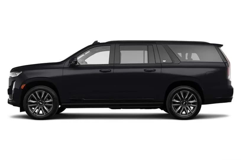
Identically from every neighborhood, which is the point of the notes: a locked hourly rate, a pickup window set the night before, FlightAware tracking on airport legs with a 30-minute arrival grace window (45 on international arrivals), and the street-level details from this page already attached to your address. The Volvo S90 books at $110 per hour, the Escalade ESV at $135, the Sprinter at $165, and a typical Camas run occupies about two hours door to curb. When luggage count decides the vehicle, the PDX vehicle selection guide runs the capacity math.
Which vehicle takes the run
The S90 handles most solo and couple departures. Families and shared trips book the Escalade, which also inherits the hill in marginal weather. The Sprinter moves group trips, youth teams, and the multi-household vacation that leaves as one vehicle instead of a convoy.
The seasonal file
Camas addresses carry seasonal notes: closure-list streets on the hill, the park bridge detour from August, event-night staging downtown. The notes exist so that January and July book the same way, with the differences absorbed on our side of the phone.
The rate that ignores the map
Grass Valley's 23 minutes and the high school side's 29 book at the same hourly rate; the difference lands in the pickup time, not the invoice. Rideshare prices the same spread as variance. We price it as scheduling, which is what it is.
Where the rest lives
The bridge, route, and transit picture for the whole run sits on the Camas to PDX guide, county-wide options on the Vancouver WA guide, and airport-side pickup mechanics on the new PDX pickup guide for Clark County.
Frequently Asked
Questions, Answered.
Which Camas neighborhood is closest to the airport?
Grass Valley, at roughly 11.7 road miles and about 23 free-flow minutes to the PDX terminal, computed over OpenStreetMap routing. The spread across the whole service area is modest: about four miles and six minutes separate Grass Valley from the far side of Camas High School's neighborhoods, with every route funneling to SR-14 and I-205.
How long does it take to get from Prune Hill to PDX?
About 24 free-flow minutes for roughly 12.5 miles, measured from the Dorothy Fox area. Prune Hill sits slightly closer to the airport than downtown by distance but rides a minute or two longer, because the descent to SR-14 is residential grade, not highway. Winter mornings can add more, which is why hill pickups get seasonal padding.
Do I need AWD to get out of Camas in winter?
Residents ask exactly this before every move to the hill, and the city's own snow policy answers it: several Prune Hill grade streets are formally closed in inclement weather, and homeowners on steep streets are told to prepare for delays. A chauffeured pickup plans around the closure list with an adjusted meeting point when the grades ice.
How much is an Uber from Camas to PDX?
Clark County riders in local threads report roughly $20 to $40 each way to PDX depending on demand, typically more on the airport return because of fees. Camas sits at the eastern edge of that range. Our alternative is a locked quote: the Volvo S90 at $110 per hour, about two booked hours door to curb, identical at any hour.
Is there a shuttle service to Portland Airport from Camas?
Shared shuttles serve Clark County on their own schedules, and the county-wide options are covered in our Vancouver WA airport transportation guide. From Camas specifically, most travelers weigh three real choices: drive and park, rideshare at demand pricing, or a scheduled private car with the pickup time guaranteed the night before.
Do you pick up in Washougal too?
Yes, Washougal is home ground: downtown pickups run about 15.6 miles to PDX, roughly 25 free-flow minutes, joining SR-14 without touching Camas at all. The flats along the Columbia also dodge most of the elevation weather that complicates Prune Hill winters, which makes Washougal one of the steadiest winter runs we drive.
About the Author
Ilyas Khairi runs Marquee Chauffeur under Portland Bureau of Transportation certification held since 2018, with $1 million in commercial liability and W-2 chauffeurs on payroll. The neighborhood notes in this guide are the working file his dispatch keeps for east Clark County, published, because a client should be able to read what their operator already knows about their street.
Verified Google Reviews
What Portland clients say about Marquee Chauffeur.
I spent six hours touring the Columbia River Gorge with the owner of this service, and I was really impressed with his professionalism, attentiveness, and local knowledge. As he says, they really are like a chauffeur/concierge, not just taking you from one place to another but providing a full experience. I look forward to riding with them again on my next trip.
Edris — has absolutely hands down have to be the best driver ever. I would absolutely recommend his service! He's so professional, so efficient. On time and so respectful!
These guys are terrific. Two thumbs up. Found them online and got excellent personal service. Used them to get from PDX to about two hours away …. And then back to PDX a few days later. On time. Super professional drivers. Vehicles in spectacular shape. Brand new. They will be out go to service. We recommend them highly.
Marquee Chauffeur holds a 5.0 rating across 198 Google reviews. Read every review on Google.
Reserve Your Chauffeur
Reserve a Portland
Chauffeur Now.
Book your neighborhood's pickup window, door to terminal. Call Marquee Chauffeur at (503) 706-8662, available 24/7. Camas and Washougal pickups are scheduled the night before with street-level notes already attached, tracked through FlightAware on airport legs, and covered by a 30-minute arrival grace window (45 on international arrivals). Volvo S90 at $110 per hour, Escalade ESV at $135, Sprinter at $165, under Portland private-for-hire permitting since 2018 with $1 million in commercial liability.